Taiwan is located in the subtropics, with abundant rainfall. However, due to extremely uneven distribution in time and space, and the steep terrain of the catchment area, low water conservation capacity, steep river slopes and rapid flow, as well as huge disparities in flow during peak and dry periods, available water resources are extremely limited. In recent years, due to the rapid development of industry and commerce, the population has increased rapidly, and the demand for water increased. However, low-cost water resources have been exhausted, and the development and utilization of high-cost water resources is beyond the current investment affordability of agriculture. In order to improve the effective utilization of water resources in the face of such difficulties and the pressure of high demand, the office has employed remote sensing system technology in irrigation water management since 1982.
The office’s current irrigation area is 12,085 hectares. The area under its jurisdiction has 7 workstations including Trunk Line, Bade, Zhongli, Guoling, Yangmei, Fugang, and Hukou, which includes New Taipei City, Taoyuan City, Hsinchu County as well as other counties and cities.
The office’s main irrigation water source is Shimen Reservoir diverted by Shimen Canal, supplemented by water diverted from river weirs and irrigation storage ponds.
the Shimen Main Canal is more than 27 kilometers in length. From upper to lower streams it also has Yuanshulin lateral canal, Shezi lateral canal, Puding lateral canal, Dongshi lateral canal, Zhongli branch lateral canal, Guoling lateral canal, Nanshi branch lateral canal, Pingzhen lateral canal, Shanxi lateral canal, Shanlu lateral canal, Huanding lateral canal, Gaoshanding lateral canal, Dajinshan direct irrigation area, Raoling lateral canal, Changganling lateral canal, and Hukou lateral canal, which divert irrigation water in the area under its jurisdiction.
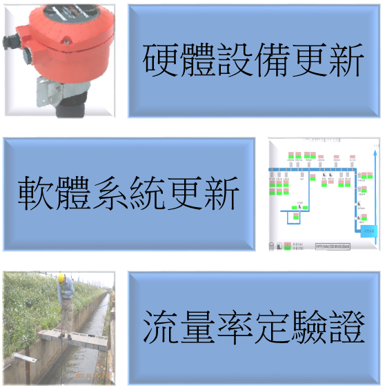
- Hardware device updates
- Software system update
- Flow rate verification
Substantive results
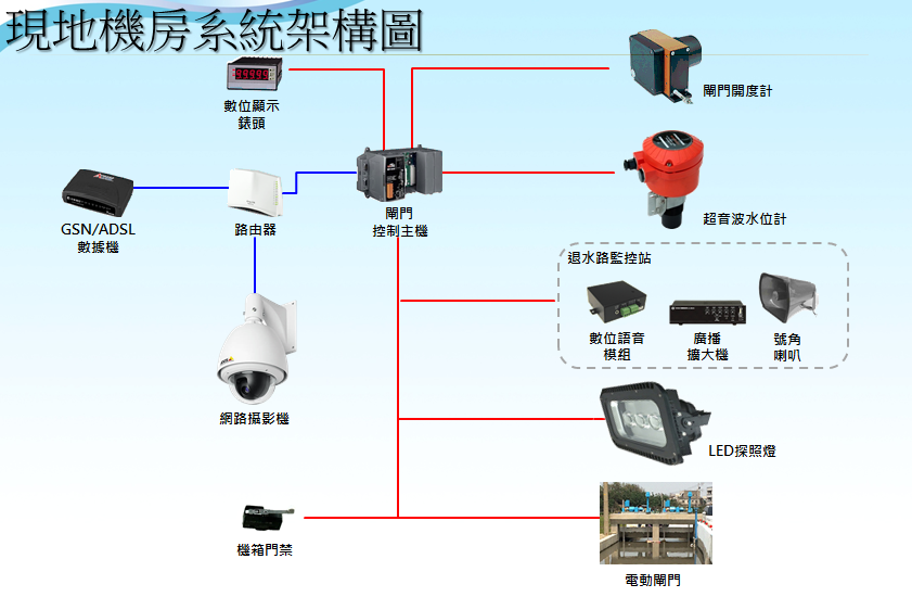
- The system monitors the flow and water level data in real time at various monitoring points in Shimen Canal, and takes water status images.
- The gate points of each important monitoring station can be controlled remotely to regulate water level and flow in real time.
- Hydrological data is saved for subsequent evaluation and analysis.
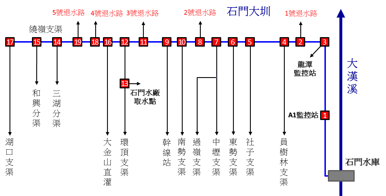
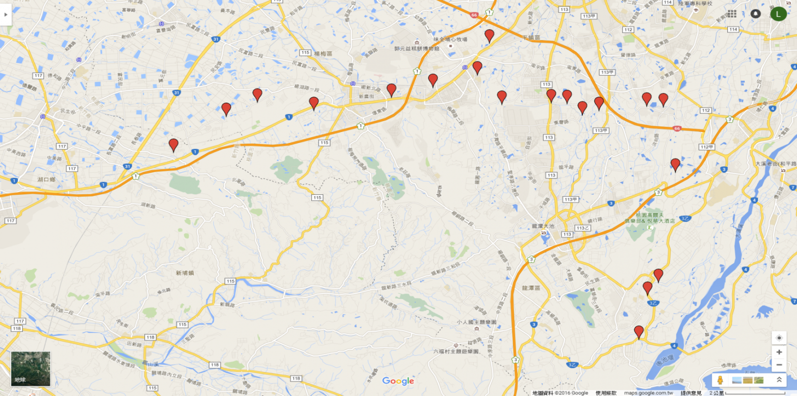
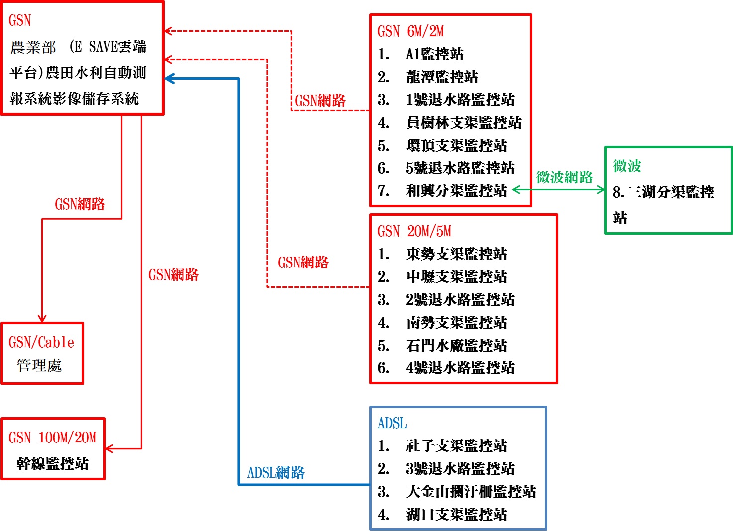
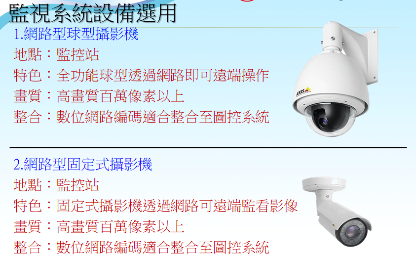
Monitoring system equipment selection
Ball shaped network camera
- Place: Monitoring station
- Feature: Full-functional ball shaped network camera operated remotely via the Internet
- Image quality: Megapixels and above high-definition resolution
- Integration: Digital network coding which can be integrated with graphic control systems
Network type fixed camera
- Place: Monitoring station
- Feature: Fixed cameras remotely monitor images through the Internet
- Image quality: Megapixels and above high-definition resolution
- Integration: Digital network coding which can be integrated with graphic control systems
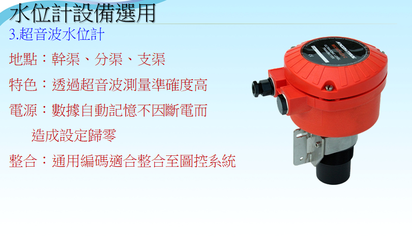
Water level meter equipment selection
Ultrasonic water level gauge
- Place: Main canal, sub-lateral canals, lateral canals
- Feature: Highly accurate ultrasonic measurement
- Power supply: Data is automatically saved and settings arenot reset to zero duringpower outages.
- Integration: Universal coding suitable for integration with graphic control systems
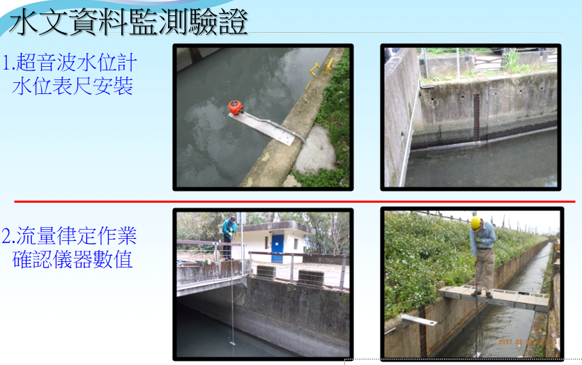
Hydrological data monitoring and verification
- Ultrasonic water level meter / water level gauge installation
- Flow calibration operation confirms instrument readings
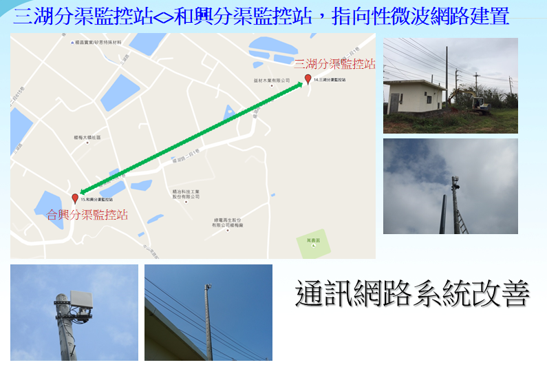
Communication network system improvement
Sanhu Sub-lateral Canal Monitoring Station → Hexing Sub-lateral Canal Monitoring Station, directional microwave network installation
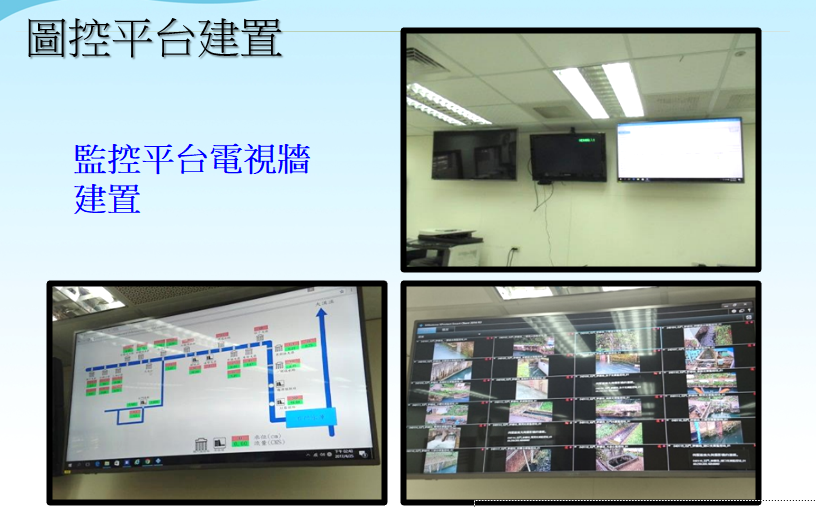
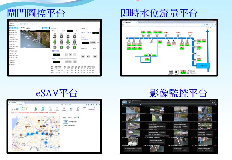
Construction of graphic control platform
- Monitoring platform TV wall installation
- Gate graphic control platform
- Real-time water level flow platform
- eSAV Platform
- Image monitoring platform
In order to improve the effective utilization of water resources, the office has completed the installation of an automation system in Guoling Lateral Canal (Phases 1 and 2) in accordance with the Advanced Irrigation Water Saving Management Promotion and Construction Plan, to automate water level, flow and gate control.
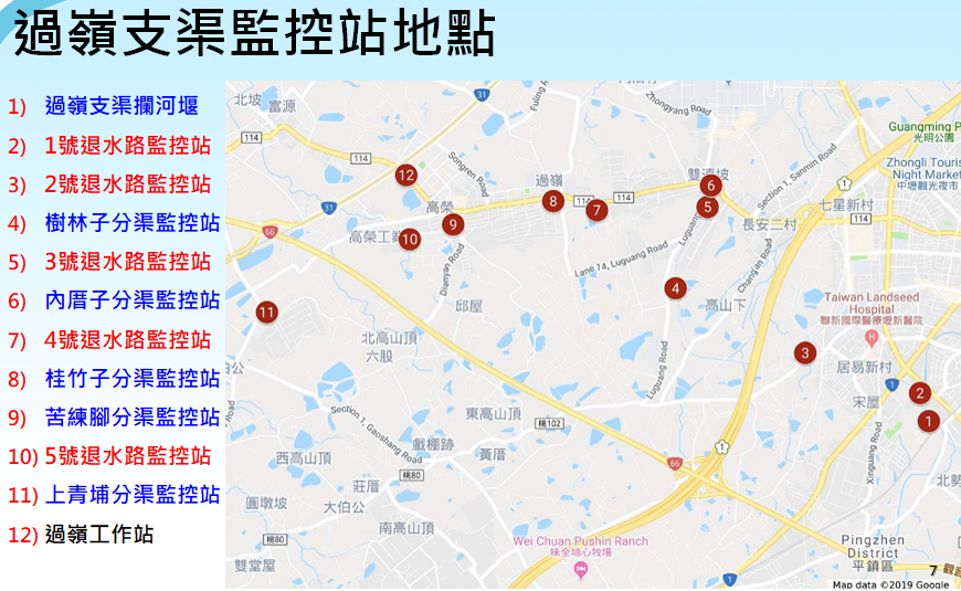
Location of monitoring station for Guoling Lateral Canal
Guoling Lateral Canal weir
- Tuishuilu 1 Monitor Station
- Shulinzi Sub-Lateral Canal Monitoring Station
- Neicuozi Sub-Lateral Canal Monitoring Station
- Guizhuzi Sub-Lateral Canal Monitoring Station
- Kulianjiao Sub-Lateral Canal Monitoring Station
- Shangqingpu Sub-Lateral Canal Monitoring Station
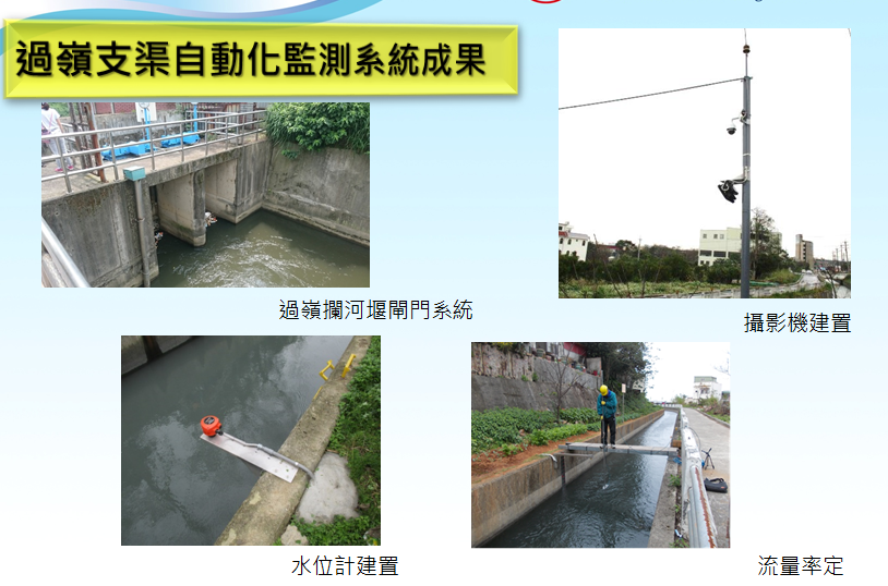
Results of Guoling Lateral Canal automatic monitoring system
- Guoling weir gate system
- Camera installation
- Water level gauge installation
- Flow rate meter installation
- Hydrological data simulation and estimation
- Through the accumulation of hydrological data, simulated usage demands can be estimated, so appropriate water resource utilization can be allocated and waste avoided.
- Set up early warning alarms in advance
- Establishing a complete monitoring system provides early warning when water levels are abnormal, facilitating the proper operation of water gates or formulation of water distribution strategies based on that warning status to avoid losses or disasters.
- Data-assisted decision-making management
- Automated logic cannot replace manual decision-making, especially in water allocation. Scientific data analysis provides more reference points for appropriate decision-making and improves water efficiency.